

Some watches tell the time. Others wait for the world to reveal it.
A luxury horological compass belongs to this second category. It does not impose information. It does not rush the moment. It remains still, silent, until the wearer opens themselves to the landscape, takes the sun as a reference, and aligns with the natural world.
Only then does the hand come alive. Time appears.
This singular achievement, both poetic and horological, gave birth to Maison Augé, the first luxury house dedicated to natural time.
An instrument that reveals time rather than delivering it
The luxury horological compass is founded on a simple and radical idea: time already exists in nature. There is no need to manufacture it artificially.
Since the origin of the solar system, the sun appears to travel across the horizon at a constant rhythm of fifteen degrees per hour. This apparent motion, unchanged for 4.6 billion years, is the world’s original dial.
Rather than reproducing this phenomenon through mechanical complexity, Augé chose to interpret it directly, relying on the most fundamental natural references: the light of the sun and the orientation of the Earth itself.
The “living” hand: when nature becomes the mechanism
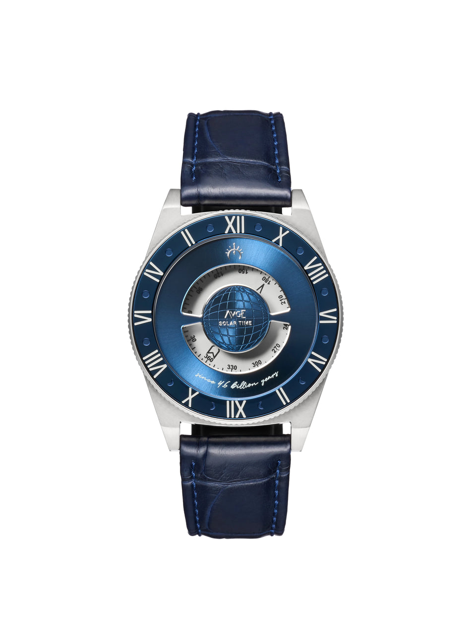
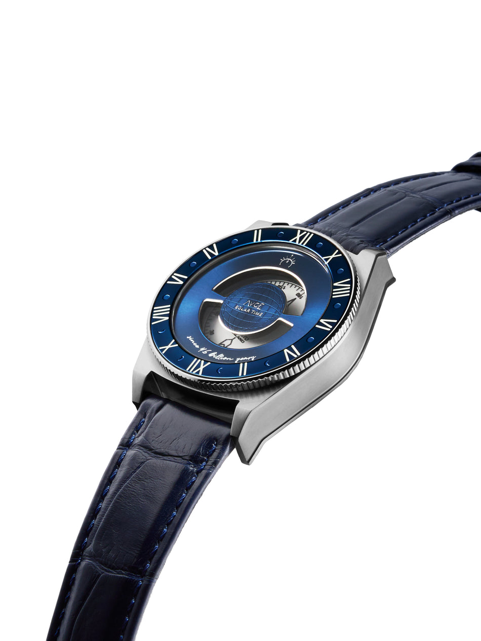
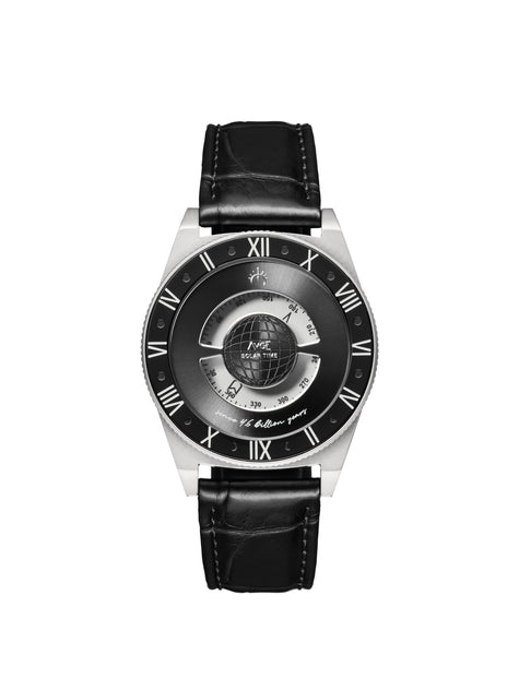
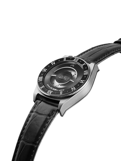
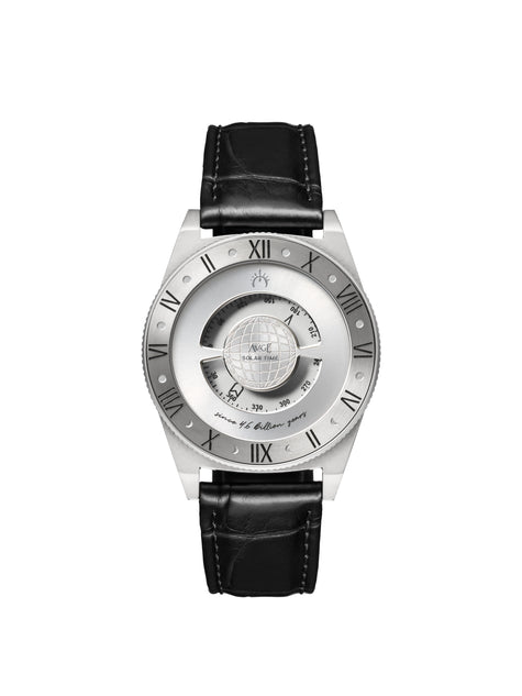
At the heart of the luxury horological compass lies a high-precision compass. This hand, perfectly motionless when left undisturbed, does not indicate time on its own.
It waits.
When the watch is laid flat on the wrist and oriented toward the sun, the hand aligns with the Earth’s magnetic poles. By comparing this fixed axis with the position of the sun, it points to the hour engraved on a solar bezel.
The hand does not calculate time. Nature expresses it.
The watch becomes an interpreter, a discreet translator between the landscape and the wearer.
Thinking like nature to read time
To understand nature, one must accept thinking as nature does. No unnecessary movement. No artificial complexity. Only stable, simple, enduring laws.
The luxury horological compass follows this same principle. Its mechanism is deliberately refined, ultra low-tech, free from electronic dependence or energy consumption.
Reading time is no longer a passive reflex. It becomes a conscious act, engaging the body, the gaze, and attention itself.
Luxury as precision, duration, and humility
In a luxury horological compass, luxury is not defined by mechanical complication, but by accuracy and restraint.
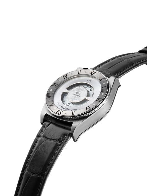
Accuracy in materials, selected for their stability and longevity. Grade 5 titanium, magnetically neutral, ensures nothing interferes with the compass hand. Anti-reflective sapphire crystal allows light to pass without distortion. An enamel dial captures and reflects the sun’s presence.
Accuracy in design, conceived to remain legible centuries from now. Accuracy in intent: not to dominate time, but to accompany it.
Who a luxury horological compass is for
It is designed for those who maintain a direct relationship with the real world.
For explorers and navigators, for whom orientation and natural reference points remain essential. For demanding contemplatives, seeking meaning rather than distraction. For lovers of ancient gestures, aware that certain forms of knowledge endure across millennia.
A subtle yet meaningful shift
We live surrounded by abundance, often without noticing it. Nature, the very miracle of life on Earth, remains our most precious wealth.
Every second, time silently orchestrates the living world. Yet we have learned to measure it without truly observing it.
The luxury horological compass was born from this gap. Not to reject modernity, but to restore a direct relationship with the real world, reconciling observation, understanding, and contemplation.
Augé and natural time
The Since 4.6 Billion Years takes its name from the age of the solar system. Since that origin, the Earth has continued to rotate, its magnetic field enduring, the sun following its apparent path.
By combining astronomical observation with magnetic physics, Augé has created a luxury horological compass capable of revealing solar time anywhere north of the equator, without batteries, without perishable mechanisms, without artifice.
An object designed to outlive its wearer, and to continue telling time as long as the sun rises on the horizon.
Time to contemplate time
Learn More